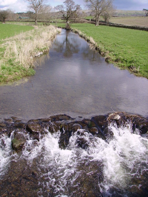
River Eea on:
[Wikipedia]
[Google]
[Amazon]
 The River Eea () is a small
see Wiktionary s.v. "ea".
/ref>
 The River Eea () is a small
 river
A river is a natural flowing watercourse, usually freshwater, flowing towards an ocean, sea, lake or another river. In some cases, a river flows into the ground and becomes dry at the end of its course without reaching another body of w ...
in the Lake District, Cumbria
Cumbria ( ) is a ceremonial and non-metropolitan county in North West England, bordering Scotland. The county and Cumbria County Council, its local government, came into existence in 1974 after the passage of the Local Government Act 1972. C ...
, England running through the Furness
Furness ( ) is a peninsula and region of Cumbria in northwestern England. Together with the Cartmel Peninsula it forms North Lonsdale, historically an exclave of Lancashire.
The Furness Peninsula, also known as Low Furness, is an area of vill ...
region, which until 1974 was part of Lancashire
Lancashire ( , ; abbreviated Lancs) is the name of a historic county, ceremonial county, and non-metropolitan county in North West England. The boundaries of these three areas differ significantly.
The non-metropolitan county of Lancash ...
. It is a relatively short system that arises from numerous small becks and streams throughout the Cartmel Valley. Its course is approximately 10 km long and its mouth is on Sand Gate marshes near Flookburgh
Flookburgh is an ancient village on the Cartmel peninsula in Cumbria, England, until 1974 part of Lancashire. Being close to Morecambe Bay, cockle and shrimp fishing plays a big part in village life.
Flookburgh is sometimes thought to derive ...
, between Barrow and Kendal. It principally flows in a south-westerly direction.
Geography
The river's source is a spring in the hills, meaning it flows all year round. Its upper course is called Whitestone Beck. The river's main tributaries are Muddypool and Ayside Beck, which converge aboveCartmel
Cartmel is a village in Cumbria, England, northwest of Grange-over-Sands close to the River Eea. The village takes its name from the Cartmel Peninsula, and was historically known as Kirkby in Cartmel. The village is the location of the 12t ...
.
The river rises near High Cark in Newton Fell and the Whitestone Enclosure, and is soon fed by ''Black Beck'' (emanating from Fair Rigg south of Staveley-in-Cartmel) and ''Ayside Pool'' (rising above Ayside).
From there, the River Eea runs past Green Bank and through Cartmel and Cark
Cark (sometimes Cark in Cartmel) is a village in Cumbria, England. It lies on the B5278 road to Haverthwaite (and to the A590 road) and is ½ mile north of Flookburgh, 2 miles southwest of Cartmel and 3 miles west of Grange-over-Sands.
It is ...
before flowing via Sand Gate Marsh
A marsh is a wetland that is dominated by herbaceous rather than woody plant species.Keddy, P.A. 2010. Wetland Ecology: Principles and Conservation (2nd edition). Cambridge University Press, Cambridge, UK. 497 p Marshes can often be found a ...
into the estuary
An estuary is a partially enclosed coastal body of brackish water with one or more rivers or streams flowing into it, and with a free connection to the open sea. Estuaries form a transition zone between river environments and maritime environm ...
of the River Leven at Lenibrick Point, close to Chapel Island. It is now used as a fieldwork study point for the Castle Head Field Studies Centre where students are able to measure variables of the river such as the stream velocity, width, depth, turbidity, pebble roundedness, sinuosity etc.
The name may be derived from a plenty of eels gathering in its lower course during high tides ("eea" was a Viking word for eel
Eels are ray-finned fish belonging to the order Anguilliformes (), which consists of eight suborders, 19 families, 111 genera, and about 800 species. Eels undergo considerable development from the early larval stage to the eventual adult stage ...
), or from the Old Cumbrian "ia" (ice), or the Old English "ēa" (a river)./ref>
Geology
To the west of the catchment area the rock is mainly slate, but to the east there are deposits of limestone. Sinkholes in the limestone can cause the river to disappear for some time.Fishing
The river is stocked with brown trout, but wild brown and sea trout are also found and fished from the river.References
{{authority control Eea History of Lancashire Eea 1Eea